Plot of the month for February 2018 is from the PRIMAVERA project as part of its user engagement activities, which explores the role atmospheric blocking plays in European weather and its effect on the energy sector.
Instead of the large-scale westerly flow that is typical of the North Atlantic, with the passage of low- and high-pressure systems and their associated cold and warm fronts, mid-latitude atmospheric blocking appears as large, quasi-stationary high-pressure systems (anti-cyclones). Atmospheric blocking is a stable atmospheric circulation that yields persistent weather over large regions for weeks to months.
Persistent dry conditions and anomalously weak winds occur below the high-pressure area. Depending on the topography and position of the blocking event, persistent rain (and potentially flooding) may occur if the unstable throughs adjacent to the high-pressure area may receive sufficient moisture (e.g., a warm water mass; for Europe, this may be the Mediterranean Sea).
The scientific and societal importance of these anticyclonic systems is explored by a 'storymap', which may be found here.
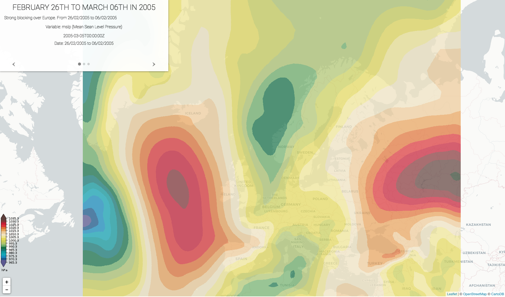
Figure | Atmospheric blocking 'storymap'. The figures shows an omega-type blocking event.